|
|
|

|
Site Index:
|
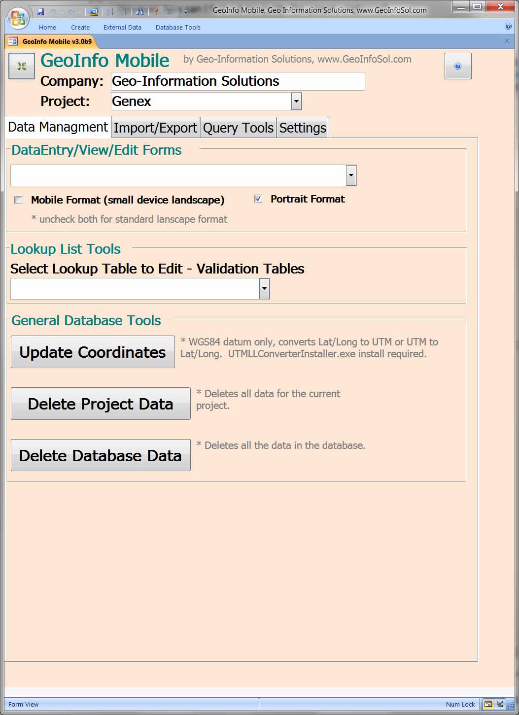
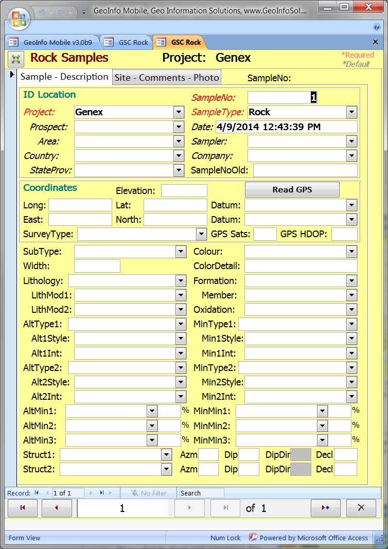
GeoInfo MobileDesigned specifically for the mining industry GeoInfo Mobile facilitates standardized and robust descriptive data collection and GPS location information for field activities.Latest News!!! GeoInfo Mobile version 2.6 for Android is now available, along with GeoInfo Mobile version 3.0 for Windows tablets.
Standardized pick lists, automated GPS locations, and defaulted common fields makes filed data entry fast and easy. GeoInfo Mobile provides clean standardized digital database ready data from field activities. Company or Project business/geologic rules are set in GeoInfo Mobile and enforced at the point of collection, the field. Post field work office data clean up is not required! Errors are reduced! Experienced geologists benefit by the speed, accuracy, and thoroughness of data collection! Junior geologists benefit by the prompting and educational benefit of robust attribute fields and properly set up pick lists! GeoInfo Mobile is fully integrated
with GeoInfo Tools, a corporate database
solution for the mining and mineral
exploration industries, http://www.geoinfosol.com/PCSoftware/GeoInfoToolsDatabase.htm.
GeoInfo Mobile is a stand alone
data collection app for geologists and
data collectors, however it is also a data
collection app for GeoInfo Tools users.
GeoInfo Mobile imports pick lists managed
by GeoInfo Tools to provide business rules
in the field, and exports collected data
for easy import into GeoInfo Tools.
GeoInfo Mobile v2.6 for Android, new for 2020 allows users to collect field data on small handheld or phone devices. GeoInfo Mobile for Android is;
Download GeoInfo Mobile v2.6 For Android User’s Manual for more details, Downloads/GeoInfo Mobile v2.6 User Manual.pdf. Download mobile device, narrow screen, version of GeoInfo Mobile v2.6 For Android User’s Manual for more details, Downloads/GeoInfoMobileUserManual.pdf. Contact
Mike.Schaefer@GeoInfoSol.com
for a free demo version. 


GeoInfo
Mobile v3.0 for Windows tablets can be
integrated with Simple GIS, ArcGIS or other
Windows GIS software allowing users to view, navigate to and
edit GeoInfo Mobile data on GIS maps in the
field. Download GeoInfo Mobile v3.0 for Windows User’s Manual for more details, Downloads/GeoInfo Mobile Users Manual.pdf.
|
|
Web Template by |
GeoInfoMobile.com © 2008 |